Northern California Places to See: 35+ Spots I’d Actually Send You To
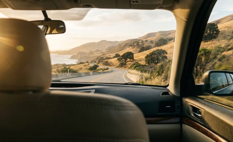
I’ve lost count of how many weekends I’ve burned driving around Northern California with no real plan, just a tank of gas and a vague idea that “the coast looks nice up there.” Some of those trips turned into the best two days of my year. A few of them turned into me sitting in a gas station parking lot in Ukiah at 9pm, tired, hungry, and annoyed that I hadn’t checked a map before leaving the house.
This list is the version of that trip I wish someone had handed me the first time. It’s organized by region instead of dumped into one giant list, because that’s the mistake I kept making: treating “Northern California” like it’s one place you can just wander through. It isn’t. It’s the Bay Area, Wine Country, the redwood coast, the Sierra foothills, and the volcanic north, and they don’t really connect the way Google Maps makes them look like they do.
Wait, What Actually Counts as “Northern California”?
Honestly, I didn’t know the answer to this for years, and it caused me more than one bad trip. Northern California generally means everything north of the Tehachapi Mountains, so that’s the Bay Area, Wine Country, the North Coast and Redwoods, the Sacramento Valley, the Sierra foothills, and the Shasta Cascade region up near Oregon. There’s no official line drawn anywhere. It’s more of a shared understanding than a real boundary.
Here’s where it gets confusing, and where I see other guides mess up. I once planned a “Northern California” trip around a list that included Big Sur and Sequoia National Park, only to realize halfway through booking that those are south of San Jose, which most people I know would call Central California, not Northern. If you’re a Bay Area local, you might even draw the line differently again, using “NorCal” to mean everything above the Bay, not including it. I’m sticking with the broader, more commonly used version here: the Bay Area north through the Oregon border, plus the foothills and valley.
A Quick Look Before You Dive In
I wish I’d had this table on my first few trips instead of figuring it out the hard way, one wrong turn at a time.
| Region | Best For | Drive Time from SF | Best Season | My Top Pick |
|---|---|---|---|---|
| San Francisco Bay Area | First visits, food, icons | 0 hours | Year round | Golden Gate Bridge |
| North Coast and Redwoods | Quiet, nature, photos | 4 to 6 hours to Humboldt | Late spring to early fall | Avenue of the Giants |
| Wine Country (Napa and Sonoma) | Couples, food, wine | 1 to 1.5 hours | September and October | Old Faithful Geyser |
| Gold Country and Sierra Foothills | History, small towns | 2 to 3 hours | Spring and fall | Moaning Cavern |
| Shasta Cascade and Lassen | Volcanoes, hiking, space | 4 to 5 hours | June through September | Lassen Volcanic National Park |
| Sacramento Valley and Delta | History, easy day trips | 1.5 to 2 hours | Spring and fall | Old Sacramento |
San Francisco Bay Area: The Famous Stuff and the Stuff I Like Better
Everyone has seen photos of the Bay Area before they ever set foot here, which honestly works against it a little. I went in expecting to be unimpressed by the obvious stuff and ended up loving most of it anyway.
The Golden Gate Bridge is the one everyone comes for, and it earns it. The bridge opened in 1937 and stretches 1.7 miles across the bay. My mistake the first time was showing up at 1pm on a Saturday, when the parking lot at Vista Point was basically a standoff between forty cars for six spots. Go early morning instead. You’ll get the bridge with almost no fog haze and no fight for parking.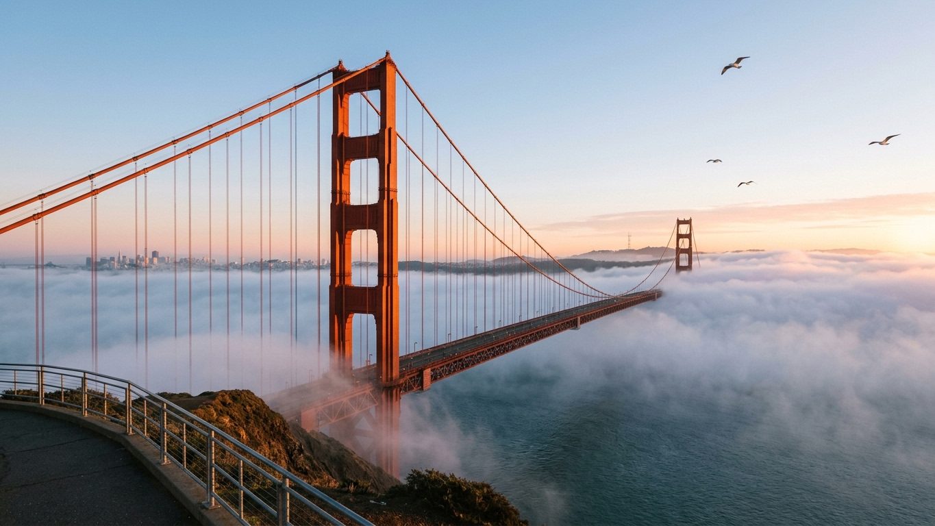
Alcatraz is worth the hype, but only if you plan ahead. I learned this the annoying way, trying to buy same day tickets in July and finding out the whole week was sold out. Book your ferry from Pier 33 two to three weeks in advance if you’re going in summer, and bring a jacket even if it’s hot on land, because the bay wind does not care about your plans.
Lombard Street is the crooked block everyone photographs, and it’s fun to see once, but the line of cars waiting to drive down it can eat half an hour of your day for very little payoff. I’d rather walk the Filbert Street Steps nearby, which give you a similar view of the city without waiting behind a tour bus.
Point Reyes National Seashore, about an hour north of the city, ended up being the surprise of one of my trips. I went for the lighthouse and stumbled onto the Cypress Tree Tunnel near the old Coast Guard station almost by accident. It’s a five minute stop that turned into my favorite photo from that whole weekend.
Muir Woods is gorgeous, but here’s a mistake worth skipping: I drove there without a parking reservation once, assuming I’d figure it out on arrival. I didn’t. Parking and shuttle slots are required year round now, so book through the National Park Service site before you go, not when you’re already in the car.
The North Coast and Redwoods: Where the Trip Slows Down
This is the part of Northern California that made me stop checking my phone every ten minutes. The coast gets wilder, the trees get taller, and the towns get smaller and quieter.
The Avenue of the Giants is a 31-mile drive through Humboldt Redwoods State Park, running alongside Highway 101, and it’s worth giving it more time than you think. I tried to do it in under an hour once, treating it like a highway instead of the point of the trip, and missed half the named groves because I didn’t stop. Give it at least half a day if you actually want to get out of the car.
Redwood National and State Parks holds the largest stretch of old growth coast redwood forest left anywhere. If Fern Canyon is on your list, and it should be, you’ll need a day use permit between roughly May 15 and September 15. I didn’t know that the first time I drove up there and had to settle for looking at it from a distance. Check the current permit window before you build your day around it.
Trees of Mystery in Klamath is a little goofy, in the best way. There’s a 49-foot Paul Bunyan statue out front, a gondola ride above the canopy, and a free Native history museum that’s better than the roadside attraction vibe outside would suggest. It’s been there since the 1940s, and it still gets me every time I drive past that statue.
Glass Beach in Fort Bragg looks incredible in photos, and it mostly delivers, though I’ll admit my first visit was a little underwhelming because I went at the wrong tide and most of the glass was underwater. Check tide times before you go, and remember you can’t take the glass home. Leave it for the next person.
Trinidad is the kind of small fishing town I didn’t expect to love as much as I did. The Trinidad Head Lighthouse Trail is an easy one mile loop, and I’ve had some of my best whale sightings here in winter and early spring, completely by accident, just standing around with a coffee.
Big Basin Redwoods State Park has a complicated story right now. It’s California’s oldest state park, dating back to 1902, and the 2020 CZU fire burned through more than 97 percent of it and destroyed nearly every structure inside. I went back in 2026 expecting a wasteland and found something different: more than 20 miles of trails have reopened, including the Redwood Loop Trail and a 4.3-mile route out to the 20-foot Sempervirens Falls. There’s even a free weekend shuttle running in summer now. It’s not the same park it was before the fire, and it won’t be for years, but it’s still worth the trip, and seeing the new growth coming back through the burned trunks hit me harder than I expected.
Wine Country: Napa, Sonoma, and the Stuff That Isn’t Wine
I’ll be honest, I went to Wine Country the first time expecting it to be all about the wine, and it was the non-wine stops that I actually remember best.
Old Faithful Geyser of California in Calistoga erupts roughly every 30 to 40 minutes, shooting up to 60 feet. My advice here is simple: don’t rush in and out. I almost left right before an eruption once because I was impatient, and would have missed the whole reason I drove there.
Sonoma Plaza is the largest historic plaza in the state, and it’s a much calmer home base than downtown Napa, especially if you’re visiting during a busy season. I switched to staying near Sonoma Plaza on my second trip after getting frustrated fighting for parking in Napa, and I haven’t gone back.
The Petrified Forest near Calistoga preserves trees buried in volcanic ash something like 3.4 million years ago. The half-mile loop trail is short enough to fit in even on a packed day, which is exactly why I keep recommending it to people who think they don’t have time for one more stop.
Castello di Amorosa is a genuine castle winery that took over 14 years to build, with underground barrel caves running more than 900 feet. Even if you skip the tasting, the building alone is worth the detour.
The Russian River Valley, west of Santa Rosa, has a slower, less polished feel than Napa, and I mean that as a compliment. Guerneville makes a great base if you want to mix a little canoeing on the river with your wine tasting instead of doing one or the other.
Gold Country and the Sierra Foothills: Where California’s Story Started
Highway 49 cuts through a string of towns that still look like 1850, and driving through them feels a little like time travel, in a good way.
Coloma, home to the Marshall Gold Discovery State Historic Park, is where gold was first found on the American River in January 1848, kicking off the whole Gold Rush the next year. You can still rent equipment on site and pan for gold yourself. I found exactly nothing the one time I tried, but my nephew found a tiny fleck and has not stopped talking about it since.
Moaning Cavern near Vallecito is big enough to fit the Statue of Liberty standing up inside it. I took the standard staircase tour the first time and the rappelling tour the second time, and if you’ve got it in you, do the rappel. Dropping 165 feet straight down into the main chamber is one of those things you don’t forget.
Sutter Creek is one of the best preserved Gold Rush towns left, and its main street is full of 19th century buildings that now hold antique shops and small inns. It’s an easy half day stop, and honestly one of the most relaxing few hours I’ve spent in the whole region.
Volcano has fewer than 150 people living in it, and it still has its original 1850s buildings, including a theater and general store. There’s a Civil War era cannon on display in town that was apparently never actually fired in battle, which is the kind of small detail that makes a tiny town worth the detour.
Indian Grinding Rock State Historic Park near Pine Grove protects a single limestone outcrop with more than 1,180 mortar holes ground into it by Miwok people over generations. I didn’t expect a rock to be one of the more moving stops on the trip, but it was.
Shasta Cascade and Lassen: Fewer People, Bigger Landscapes
This corner of the state gets skipped by a lot of travelers, which is exactly why I keep going back. Fewer crowds, more space to breathe.
Lassen Volcanic National Park is the only place on Earth where all four types of volcanoes exist in one park. The 2021 Dixie Fire burned a real chunk of it, and the damage isn’t even across the park. Trails on the west side along Highway 89 came through mostly fine, while the east side took the worst of it. I’d check the park’s current trail status before you build a route around any specific trail, since this changes season to season.
Bumpass Hell is Lassen’s largest geothermal area, with boiling mud pots and steam vents connected by a boardwalk. The sulfur smell is strong enough that I’ve seen people turn around five minutes in. Stick with it. It’s worth pushing through the smell.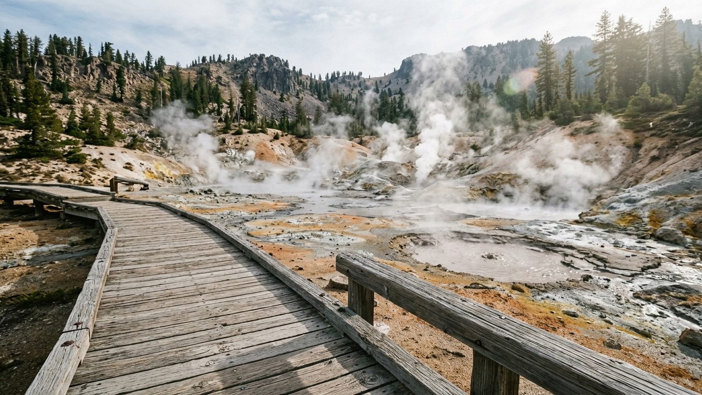
Sundial Bridge in Redding is a pedestrian bridge designed by Santiago Calatrava that doubles as the world’s largest working sundial. Go at sunrise or sunset. I went at noon once thinking it wouldn’t matter, and the photos were flat and boring compared to what I’ve gotten there at golden hour since.
Mount Shasta is a 14,179-foot dormant volcano that you can see from miles away in every direction, and it’s considered sacred by several local tribes. You don’t need to summit it to get something out of the visit. The drive up to Bunny Flat or Panther Meadows gives you a close up view that doesn’t require any real hiking gear.
Lava Beds National Monument in Siskiyou County has more than 800 documented lava tube caves, more than anywhere else in North America. Skull Cave and Mushpot Cave are both manageable if you’ve never caved before. Bring your own flashlight even if they say one is provided. Mine died halfway through Skull Cave and I was very glad I’d packed a backup.
Sacramento Valley and the Delta: The Region Everyone Drives Past
This part of the state gets treated like a thing to get through on the way to somewhere else, and that’s a mistake I made for years before I actually stopped here on purpose.
Old Sacramento is a 28-acre historic district along the river, with wooden boardwalks and buildings from the 1850s still standing. The California State Railroad Museum sits right inside the district and holds one of the largest restored locomotive collections in the country. I went in thinking I’d spend twenty minutes and left two hours later.
Locke is a town built entirely by Chinese immigrants in 1915, after a fire destroyed the original Chinatown section of nearby Walnut Grove. It’s the only town in the country built this way, and a lot of the original architecture is still standing along its one main street. It’s quiet, almost too quiet, but that’s part of what makes it memorable.
Sutter’s Fort State Historic Park was built in 1839 by John Sutter, before Sacramento was even a city, and now sits fully restored right in the middle of downtown. It’s a strange, good kind of contrast, walking out of a 1839 fort and straight back into modern traffic.
How I’d Plan This If I Only Had a Few Days
If I’m being honest, the biggest mistake I made on my early trips up here was trying to see too much. Here’s how I’d split your time now.
One day: Pick one region and stay there. Wine Country, Point Reyes on the coast, or Sutter Creek in Gold Country all work well as a single, focused day. Don’t try to combine two.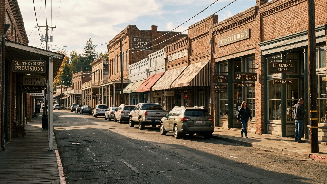
A two day weekend: Pair the Bay Area with one region next door, like Wine Country, and keep your total driving under three hours each way. This was my first “good” trip, the one that didn’t end in a gas station parking lot.
Four or five days: Loop it. San Francisco to Wine Country for a day or two, then up to the North Coast and Redwoods for two more, then back down Highway 101. Keep each driving leg to two or three hours instead of one long, exhausting haul.
A week or more: Add Gold Country and Shasta Cascade onto that loop. A full circuit through the coast, mountains, valley, and foothills realistically takes seven to ten days if you actually want to get out of the car at each stop instead of just driving past it.
Picking Spots Based on Who’s Coming With You
Traveling with kids: Trees of Mystery in Klamath, Sundial Bridge and Turtle Bay in Redding, Old Sacramento and the Railroad Museum, Old Faithful Geyser in Calistoga.
Traveling as a couple: Sonoma Plaza, the Point Reyes lighthouse and Cypress Tree Tunnel, wine tasting in Russian River Valley, sunset at the Golden Gate Bridge Vista Point.
If you’re chasing photos: Avenue of the Giants, Glass Beach at golden hour, Lombard Street from the Filbert Street Steps, Mount Shasta from Panther Meadows.
If you actually want to hike: Lassen’s Bumpass Hell Trail, Fern Canyon in Redwood National Park (permit required), Mount Tamalpais State Park, the newly reopened Skyline to the Sea segments at Big Basin.
If this is your first trip up here: Golden Gate Bridge and Alcatraz, one winery in Napa or Sonoma, Muir Woods, and the Avenue of the Giants. That combination alone will give you a real feel for the range of this region.
Things I Wish I’d Known Before Going
The best time of year is late spring through early fall, roughly May to October, for most of these regions without weather getting in the way. Wine Country and the foothills stay pleasant nearly all year, while the coast stays cool and foggy in summer and gets properly wet from November through March.
Check current conditions before you commit to a route, especially anywhere touched by recent wildfires. Parts of Big Basin Redwoods and parts of Lassen Volcanic National Park are still in long term recovery from past fires, and trail access shifts season to season. I got burned once by relying on an old blog post that hadn’t been updated in years and showed up to a closed trail. Check the park’s own website or Caltrans QuickMap shortly before you leave, not weeks ahead.
For how many days you actually need, two to three days covers one region comfortably, whether that’s the Bay Area, Wine Country, or Gold Country on its own. Seeing a real cross section of the coast, mountains, valley, and foothills together takes closer to seven to ten days.
Frequently Asked Questions
What is considered Northern California? Northern California generally means the part of the state north of the Tehachapi Mountains, including the Bay Area, Wine Country, the North Coast and Redwoods, the Sacramento Valley, the Sierra foothills, and the Shasta Cascade region up to the Oregon border. There’s no official boundary drawn anywhere, so different people use the term slightly differently, but this is the most common scope.
How many days do you need to see Northern California? Two to three days is enough to cover one region well, like the Bay Area or Wine Country. A fuller loop touching the coast, mountains, and foothills takes closer to seven to ten days. I learned the hard way that trying to do it all in under a week mostly just means more time in the car.
Is Yosemite considered Northern California? Yosemite sits in the central Sierra Nevada and is usually classified as Central California, not Northern California, since it’s south of the Bay Area and Sacramento. People often group it with the Gold Country trip anyway, but technically it falls outside the core Northern California region.
What’s the most beautiful part of Northern California? It depends on what you’re drawn to. The North Coast and Redwoods region gives you the most dramatic natural scenery, with old growth forest and a rugged coastline, while Wine Country gives you a more polished, postcard kind of beauty with rolling vineyards. I genuinely can’t pick a favorite between them, and I’ve stopped trying.
Is the Bay Area part of Northern California? Yes, in almost every common use of the term, but some Northern California locals outside the Bay use “NorCal” specifically to mean the area above the Bay, separating it culturally from the more urban, tech driven Bay Area. Both versions are used often enough that it’s worth knowing the difference when you’re reading other guides.
What’s the best time of year to visit? May through October works well for most of the region, with September and October adding wine harvest season in Napa and Sonoma on top. Winter brings rain and fog to the coast, but it’s also a good window for whale watching around spots like Trinidad and Point Reyes.
Is it safe to visit Big Basin and Lassen after the wildfires? Yes, both parks are open with restored trail sections, though both are still in long term recovery. Big Basin has more than 20 miles of reopened trail as of 2026, and most of Lassen’s west side trails along Highway 89 came through the 2021 Dixie Fire largely undamaged. I’d still check each park’s current trail map before you go, since open sections shift with the seasons.
Where I’d Start If I Were You
If you take nothing else from this, take this: plan by region, not by a single giant list. I spent years trying to hit every name I’d ever heard of in one trip, and it just meant more driving and less actually standing in front of any of it.
Pick the region that fits the time you’ve got. If it’s a weekend, pair the Bay Area with Wine Country or the closer stretch of the coast and keep your driving honest. If it’s a week, build the loop. And whatever you do, check current trail and road conditions for anywhere touched by fire before you leave the driveway. I’ve made that mistake more than once, and it’s an easy one to avoid now that you know where to look.